16 Days in Kursk in Maps
From ISW (Institute for the Study of War). All the maps, except the first, are at the same scale. One map per day, August 7 through August 22 (and yes, that’s 16, not 15. Think about how many maps there were August 7 through August 10. Not 3. That’s math.)
It’s not clear what the objective is – to boost morale? to harm the enemy’s morale? Those have been met, to some extent. To take territory? To take more territory? To create a buffer zone? To hold territory? Zelensky mentioned the buffer zone – which is likely part of the objective, making all of those objectives, which may be met. To cause a leadership or command and control crisis? Hard to say, but that might be, partially, a side-effect. To pull Russian divisions out of eastern Ukraine to defend Kursk? That hasn’t happened.
The area in blue today is about the size of Rhode Island.
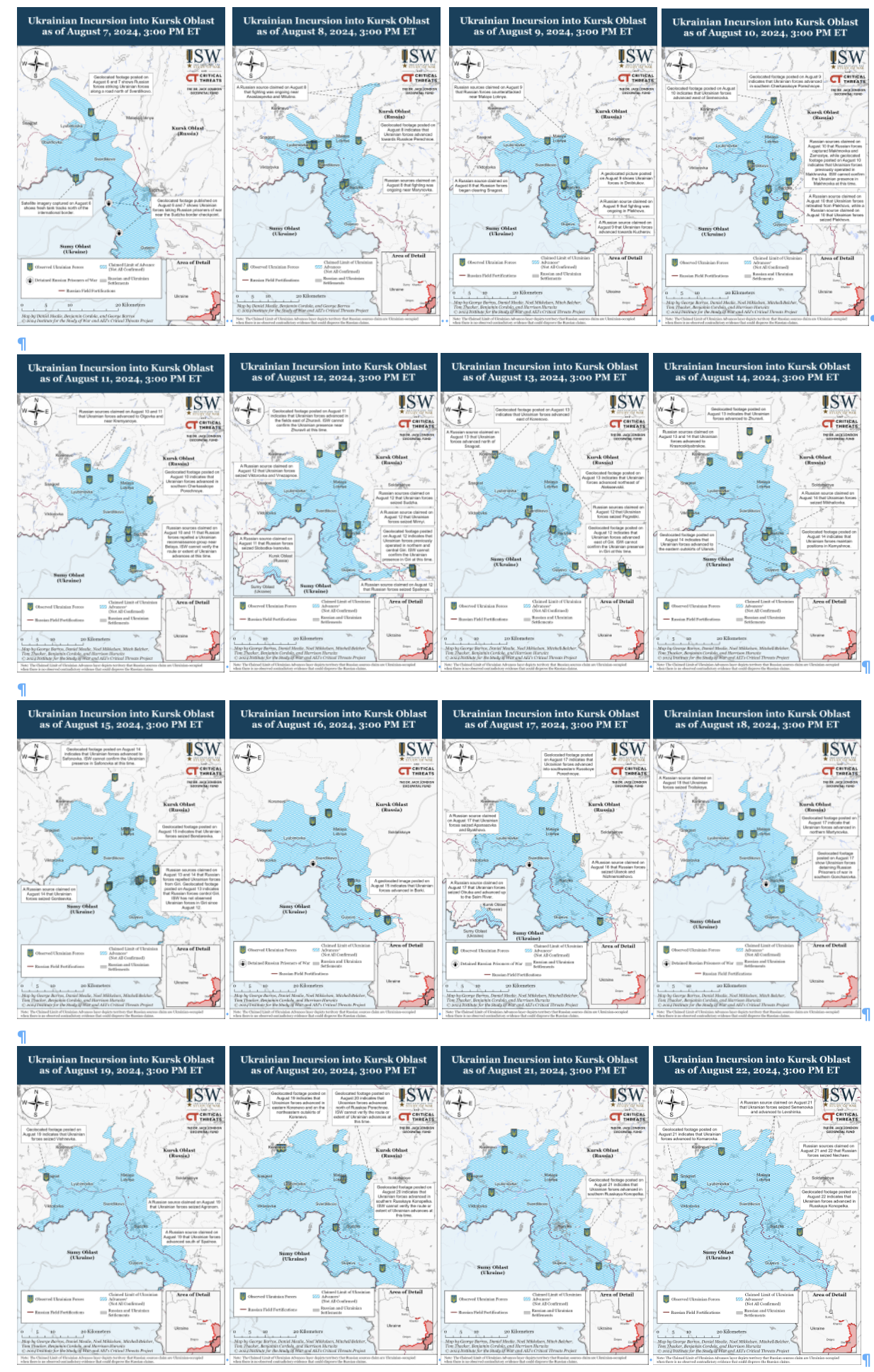
The blue part is still getting bigger, but not as rapidly as ten days ago. I think it helps to see the maps when reading the latest news.
Oh, one more theory, floating through rumor mills, and I’ve also seen it in print: the objective or an objective might be – to have territory to trade when negotiations finally begin.
I have been reading a lot about this war. I hate this war. I hate the killing and destruction. I hate the loss of life. And I am fascinated by, and absolutely terrified of, the massive use of drones – observation, loitering munitions (essentially flying bombs), heat sensing… But while I hate this war, I read a lot about it, mostly, and ironically, from two deeply pro-war sources – ISW is one of them (I only reluctantly linked, and that’s because I used their maps), and one of the Russian milibloggers (military bloggers), the Fisherman (Rybar, Рыбарь), is the other. I guess I could put up Rybar’s maps, but they are far more detailed, and harder to parse at a glance.


Trackbacks